Issues Near High Bridges (or other Skyline areas)
During my travels over the last few months, I've noticed that areas where I either travel over a high bridge or I am in an area with a clear line-of-sight to a large area (5 miles or more), I encounter issues where the RSRQ/quality goes close to -20 (bad quality).
I have some thoughts as to the cause of this but I am not an expert by any means.
- Beam tilt (angle antennas face) on the tower are not going closer to the ground. If the Beam tilt is not angled closer to the ground, my vehicle (which is higher in the air on the bridge) will have a strong signal from many competing towers if the antennas are pointed too high. Imagine being in a line-of-sight view of multiple cell nodes/towers.
- Somewhat related to #1 is the fact that being in range of multiple nodes/towers means that the context of the user equipment/cell-phone changes often (IE: switching to a different node/tower, different band, mode, etc). I don't know how intensive this context switching is for the cell-phone but would imagine that multiple hand-offs in a short-period of time could cause issues.
- Maybe the issue is just with congestion and a lot of vehicles traveling over the bridge? I don't think this is the case because I would encounter congestion in other areas of the turnpike as well. It would be another issue if we were stopped in traffic on the bridge as well.
Some areas that this happens in (near me) are on the bridge from the NJ turnpike to PA (276) and the bridge the Route 1 bridge from PA to NJ (near Trenton). I may do analysis on them again later.
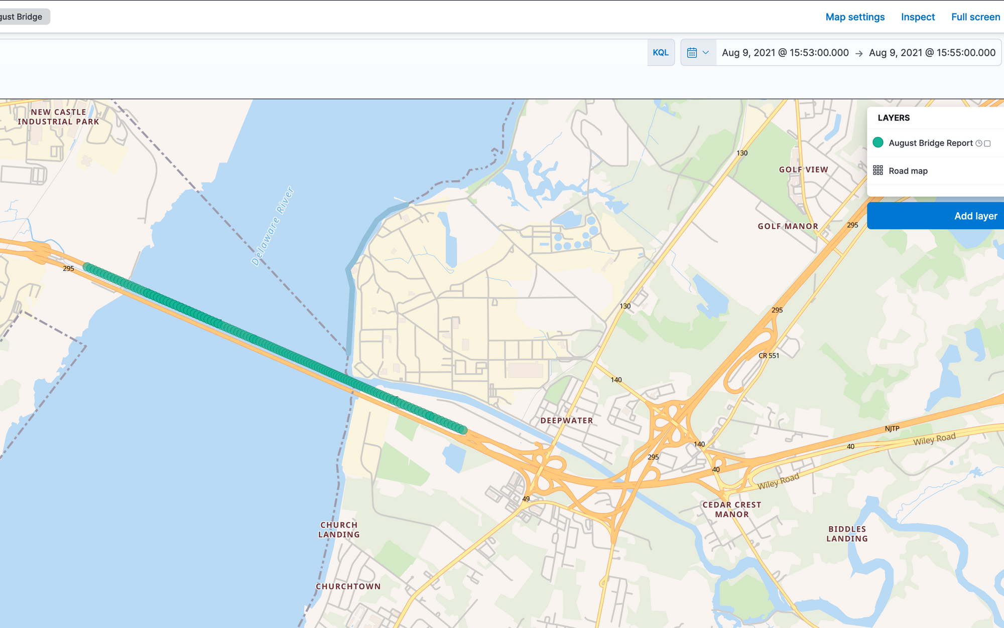
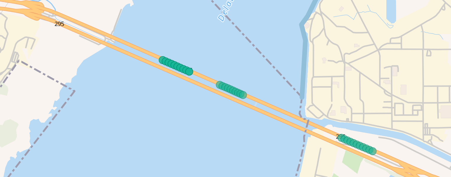
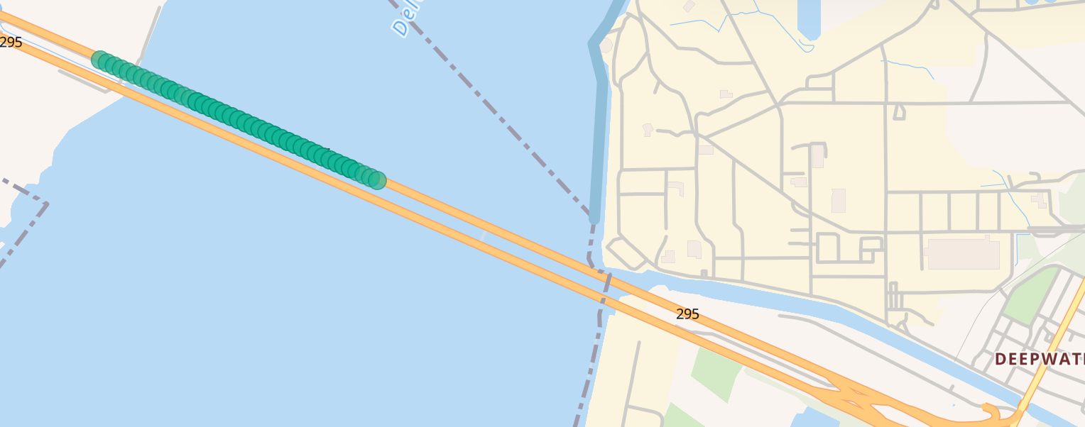
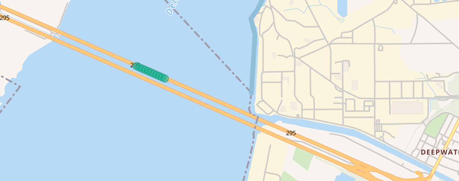
For this article, let's go back to the trip I made to Maryland in August to look at the lower RSRQ values and see if any of my thoughts make sense. I am going to look at the point in time when I went over the Delaware Memorial Bridge. I was traveling over the bridge between 3:53 PM and 3:55 PM as shown in the screenshot below. The green is the path my car took during those times.
I'm just providing information at this point and hypothesizing about these findings. Might not always solve the question at hand.
Here are the plots for each carrier when the signal quality was at -20
T-Mobile (42 Plots)
AT&T (69 Plots)
Verizon (11 Plots)
Now let's look at the node-cell combinations that showed up for each carrier
T-Mobile
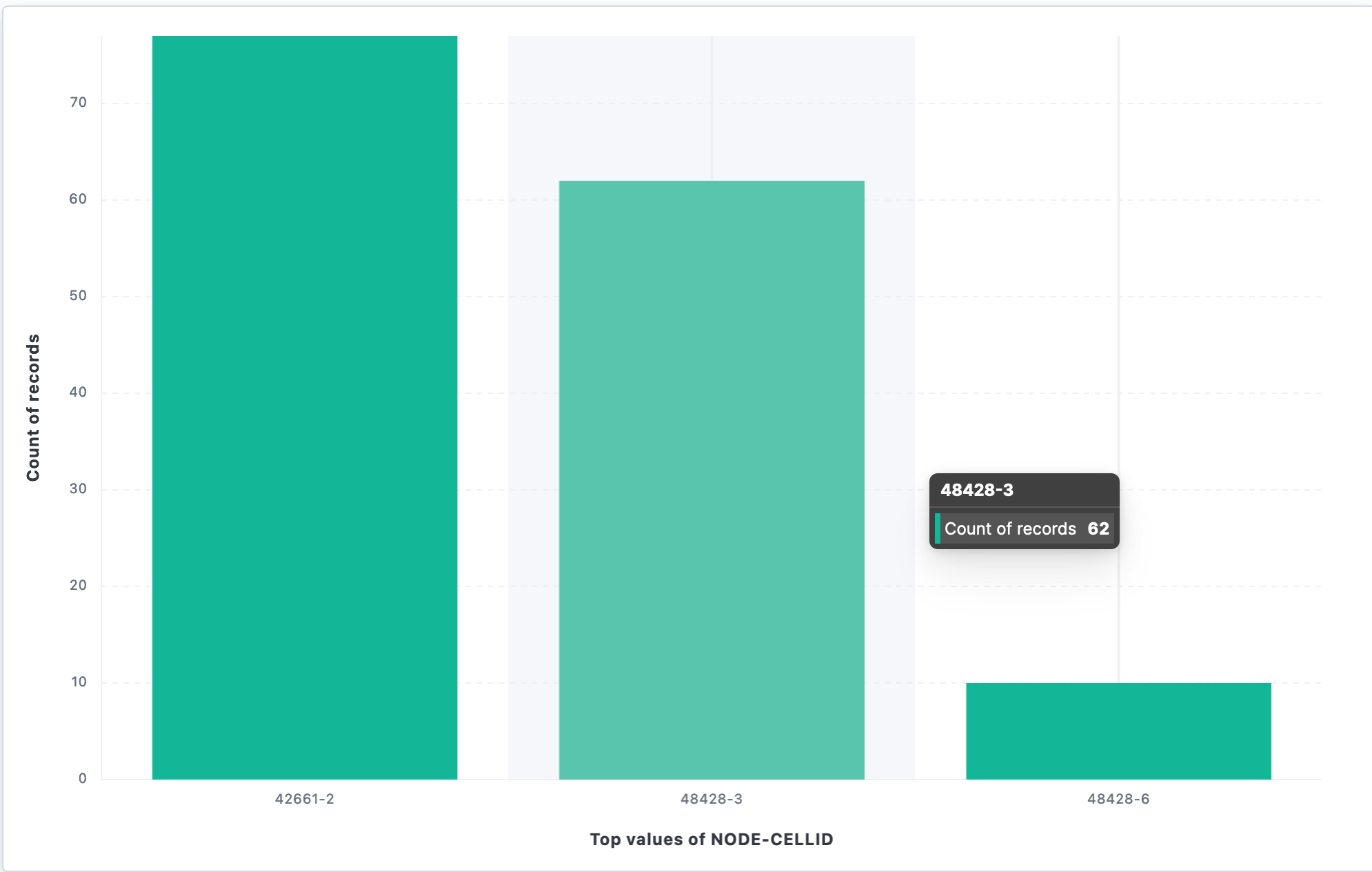
This tells us that 2 nodes (48428 and 42661) were in range during our travels over the bridge for T-Mobile. For 48428, we seen two cells (3 and 6). I didn't see as much context-switching like I thought with T-Mobile. The signal stayed with the same node/cell (it did not continuosly move back and forth between nodes/cells like I thought).
Let's look at this information on CellMapper
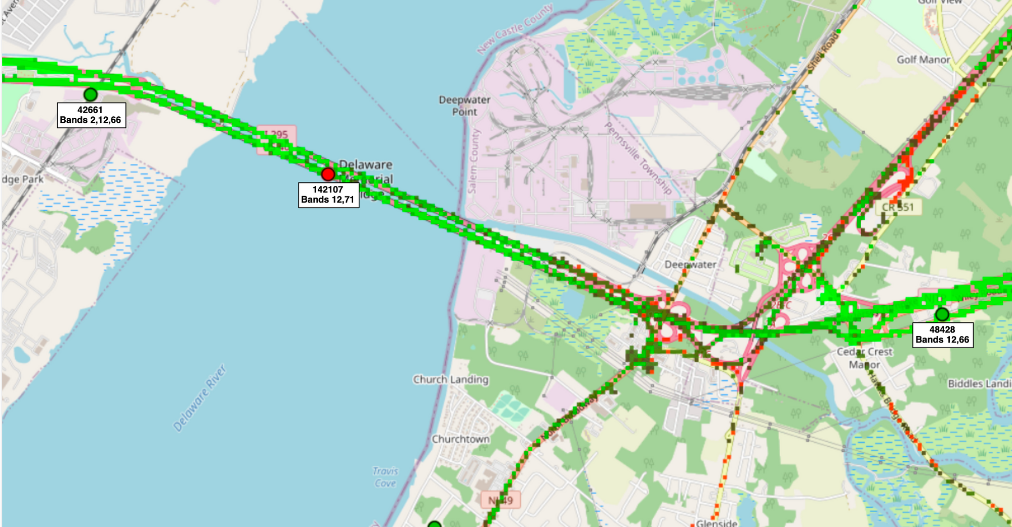
We see that 48428 is on the NJ-side of the bridge, there is a band 12/71 site in the middle of the bridge (which I didn't pick-up) and the 42661 on the Delaware side of the bridge.
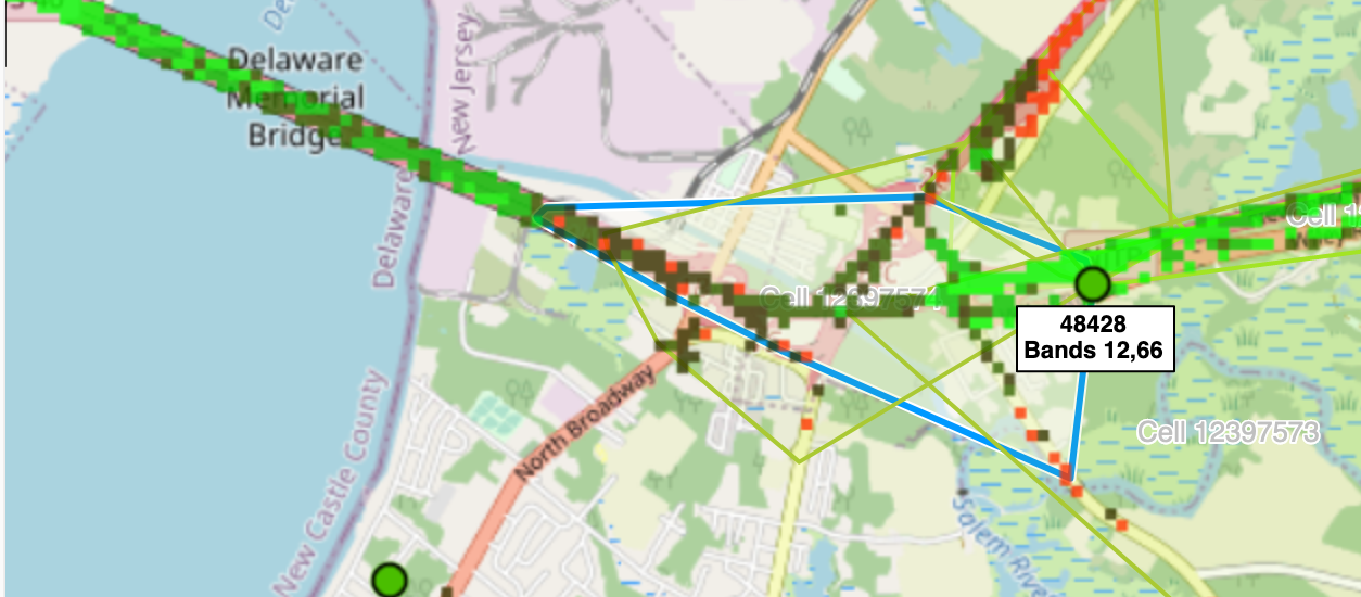
Cellmapper showed that node 48428, cell 3 covered this approximate area
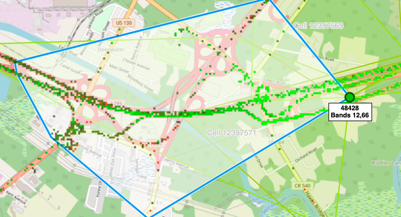
48428, cell 6 covers this area
Node 48428 covered about half-way across the bridge. In the middle of the bridge, 42661 picked things up. That makes sense.
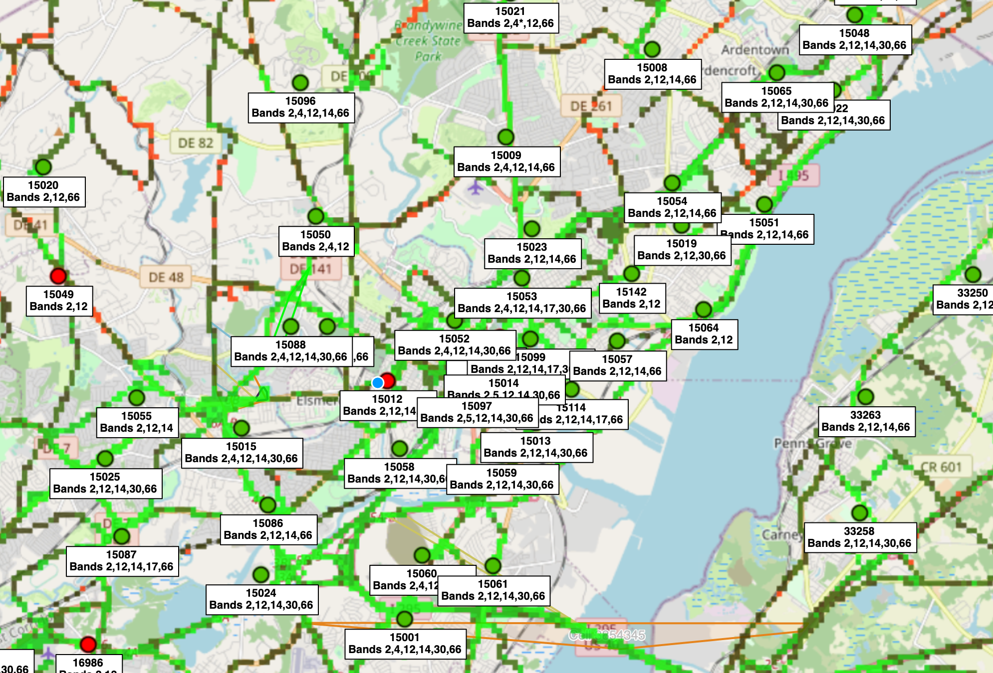
AT&T
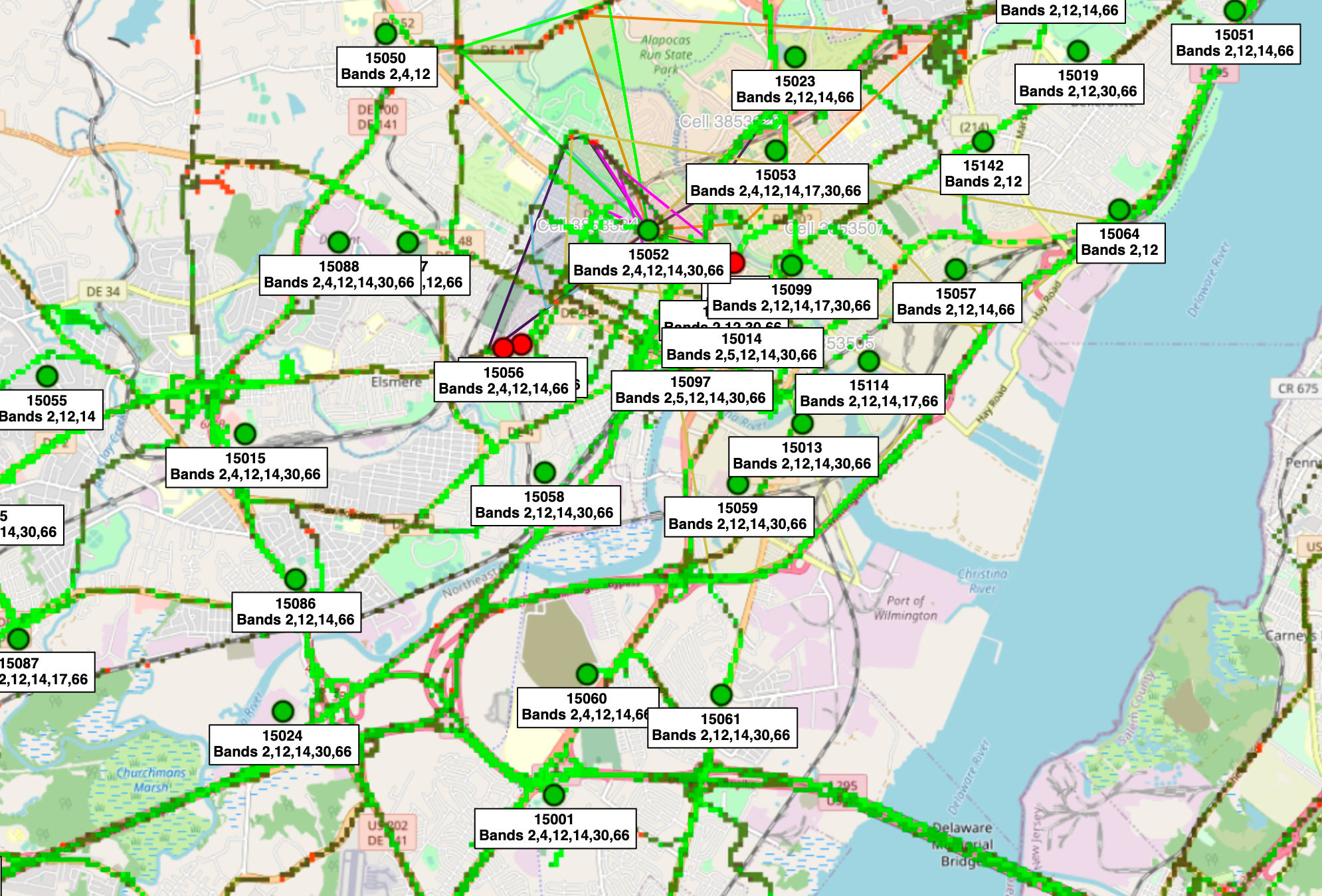
AT&T had 8 unique nodes. They also had the most bad plots of low quality/RSRQ (69). There were also a few points where the phone appeared to have no signal but this could have been an issue with the phone (not sure). I'm not going to count that here. Let's look at Cellmapper for them
In the middle of the bridge (closer to Delaware) is where the quality started to degrade.
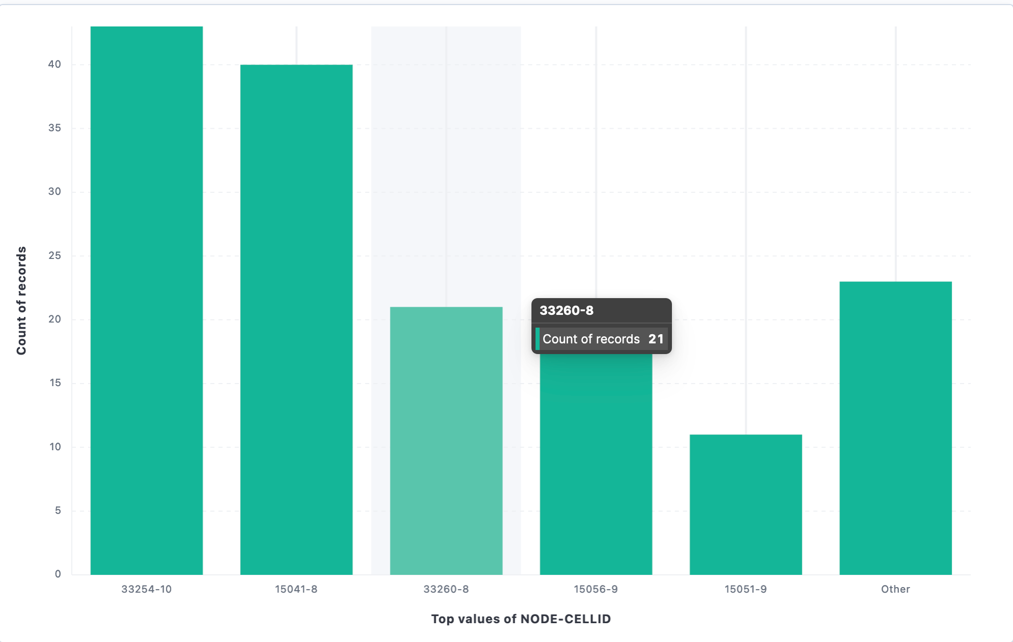
Of the bad plots, here were the nodes/cells that showed up:
15041-8
If Cellmapper is correct with this site, it is located far South of the bridge (US-13 and Bear Road) which is 10 miles away (by road). Maybe this tower is not positioned correctly in Cellmapper. If that is not the case, why is this site picking up the signal from the bridge when other nodes/sites are closer? Maybe this antenna is not angled far enough down?
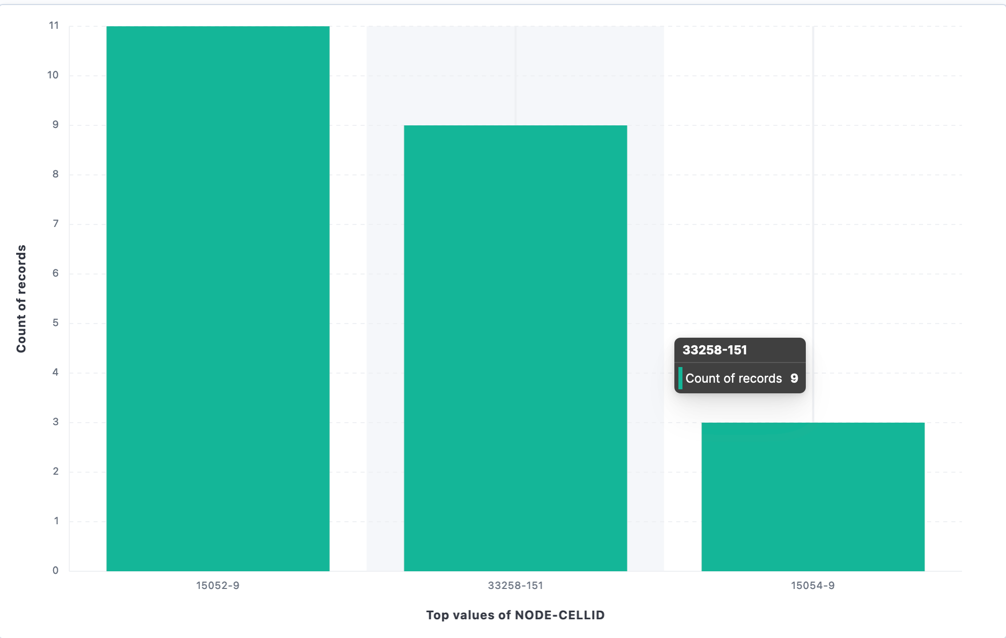
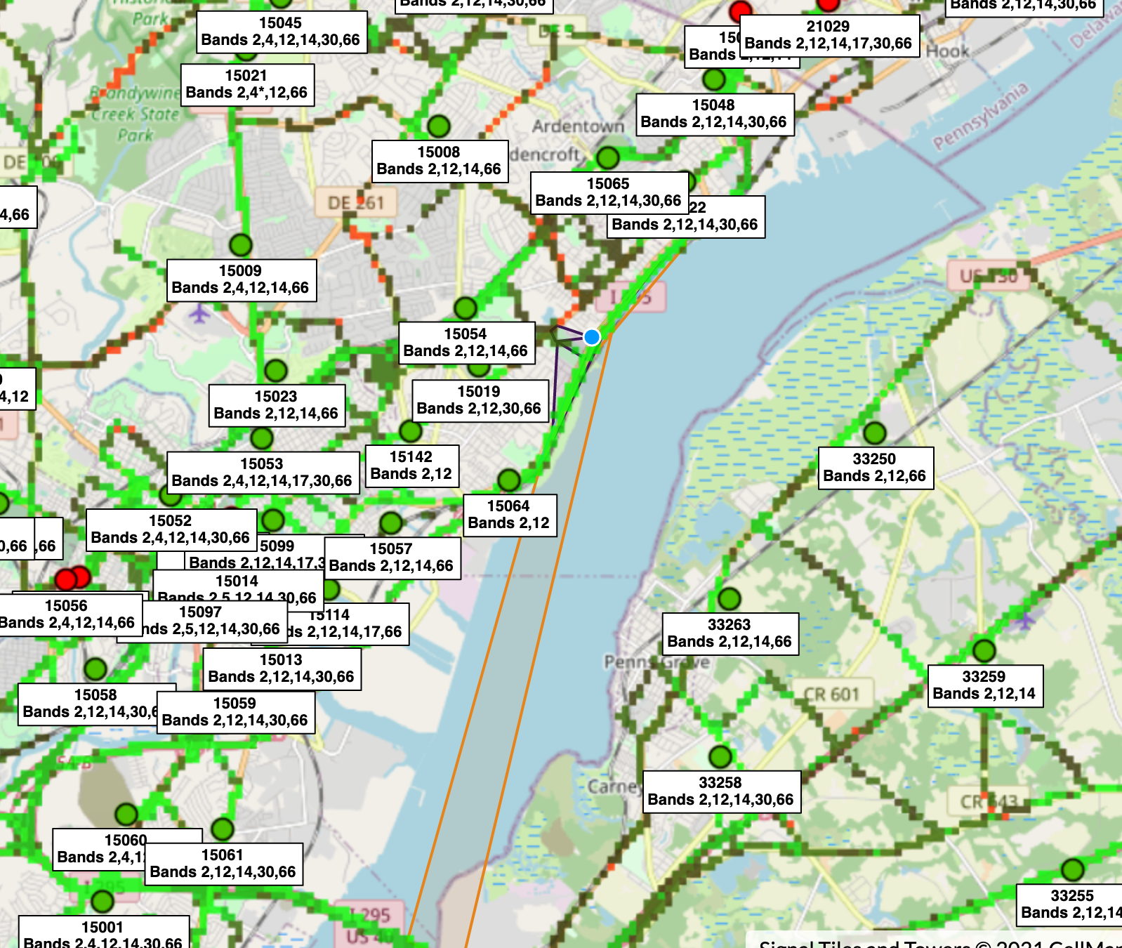
15054
Another one far away but coverage beam (from Cellmapper) shows coverage to the bridge
15056-9
This position appears to be off in Cellmapper. The actual node is in the middle of the screen but the coverage of the cell (which is hard to see) shows the bridge.
15052-9
This one is also far away. On this shot, I am showing the calculated cell coverage. Again, this may be a Cellmapper issue and the geographic location of this node is off.
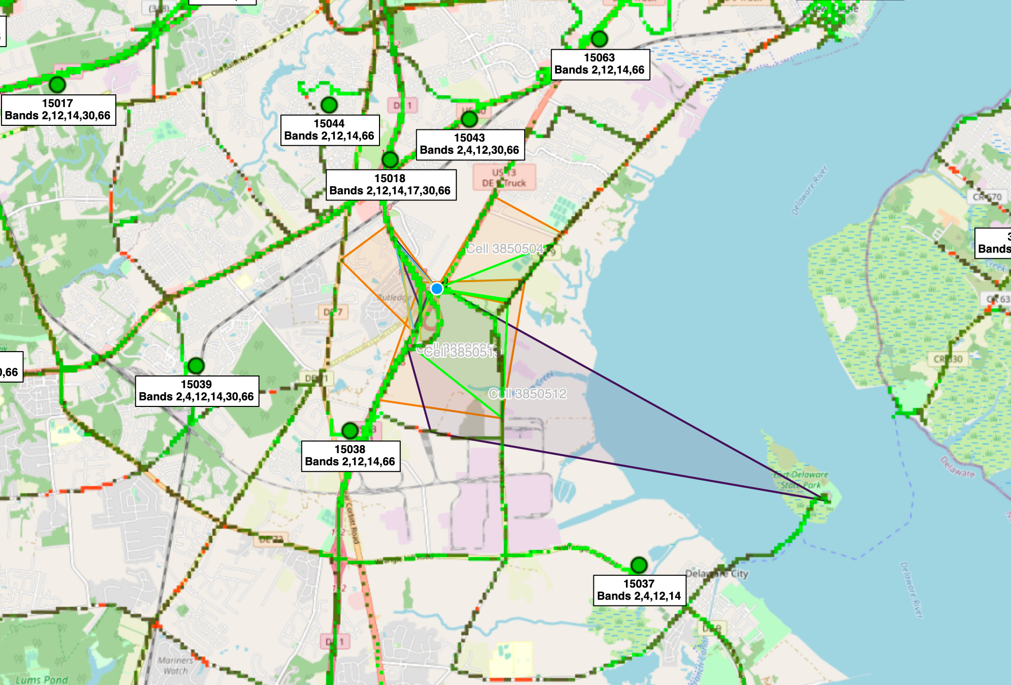
15051
Another one far away but the coverage beam (from Cellmapper) shows this.
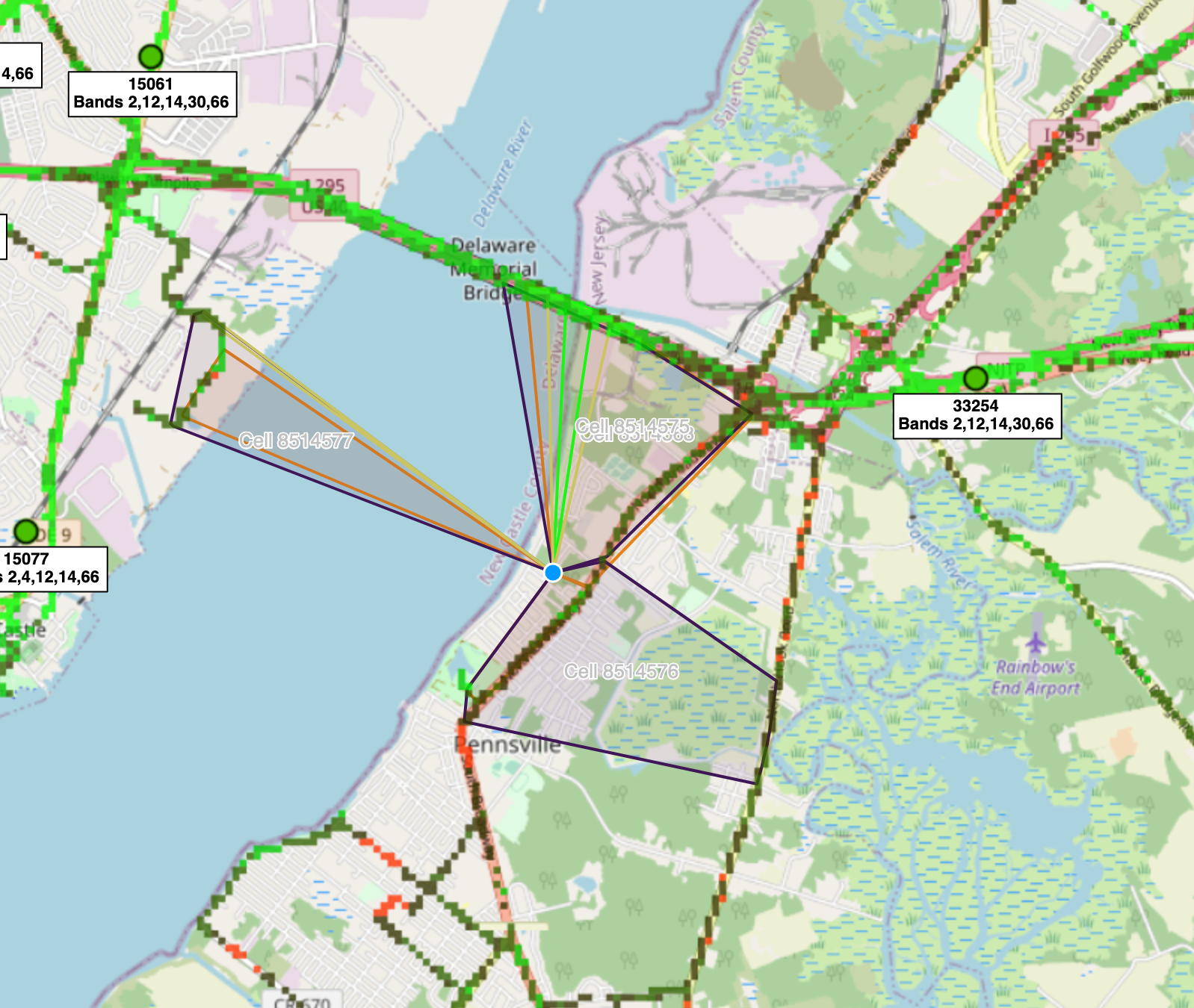
33254
This was on NJ side of bridge.
32258 (not seeing this one on Cellmapper yet)
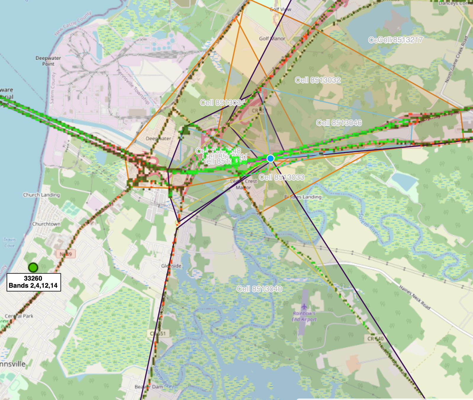
33260
Also on NJ side.
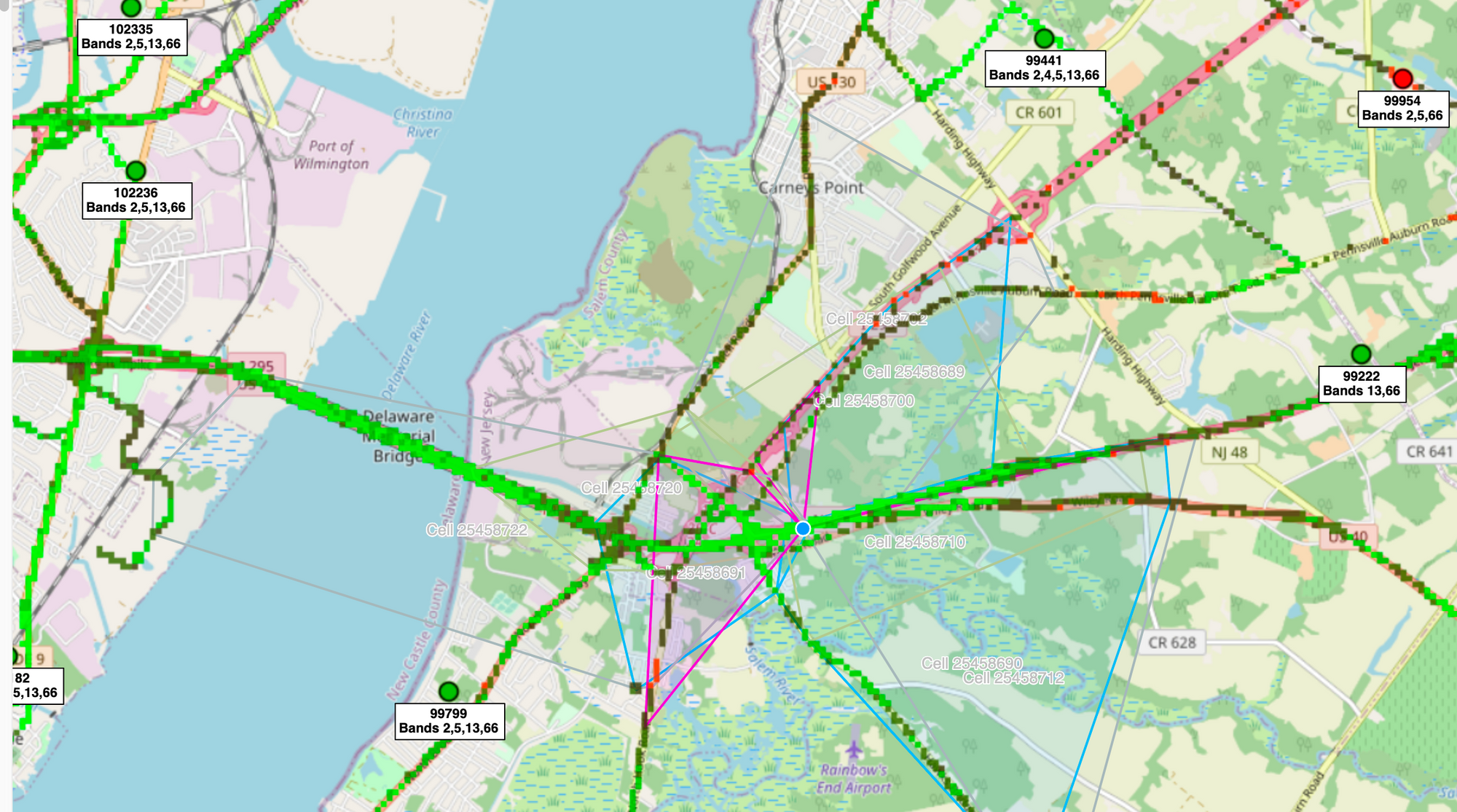
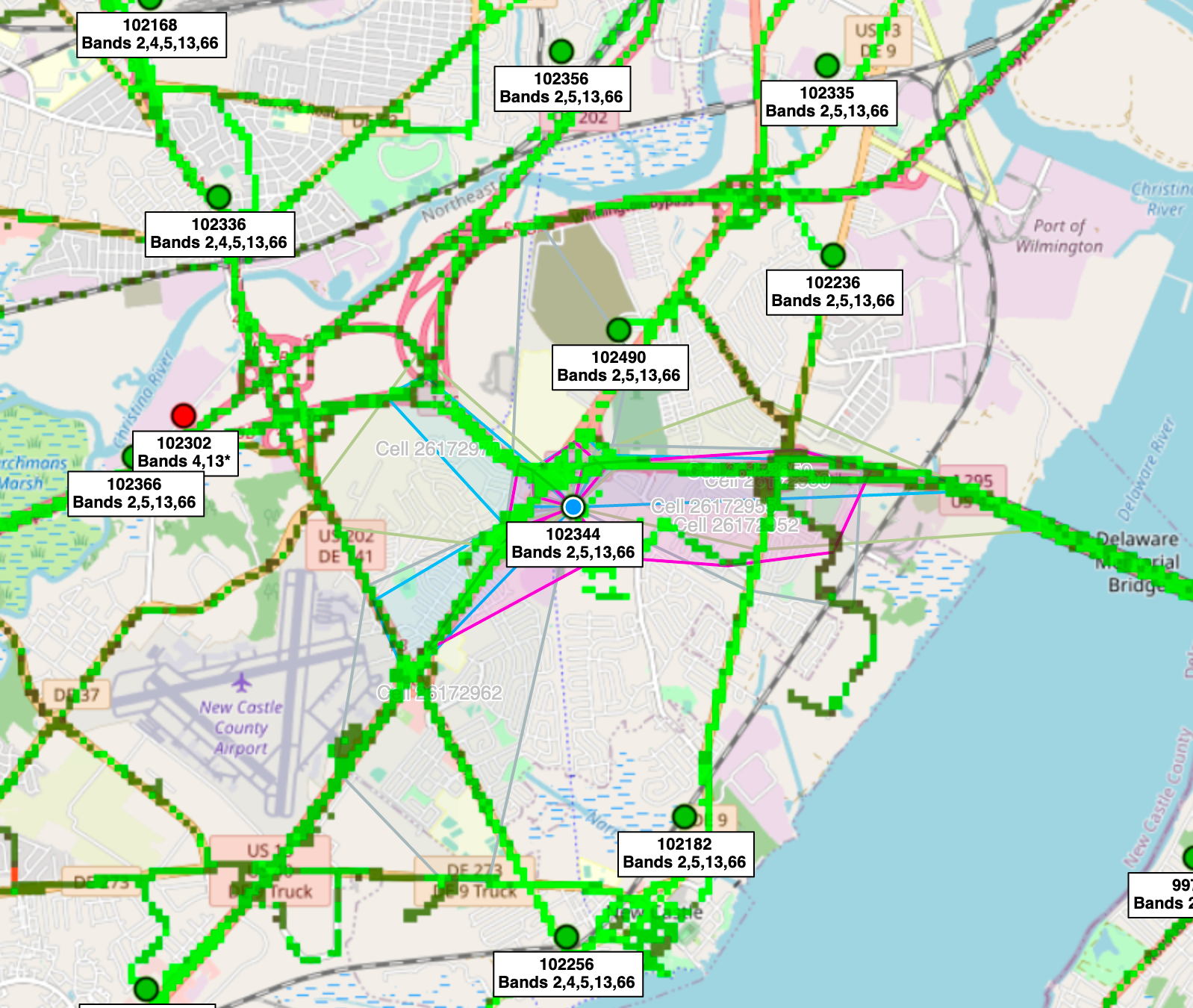
Verizon
5 unique nodes shown here.
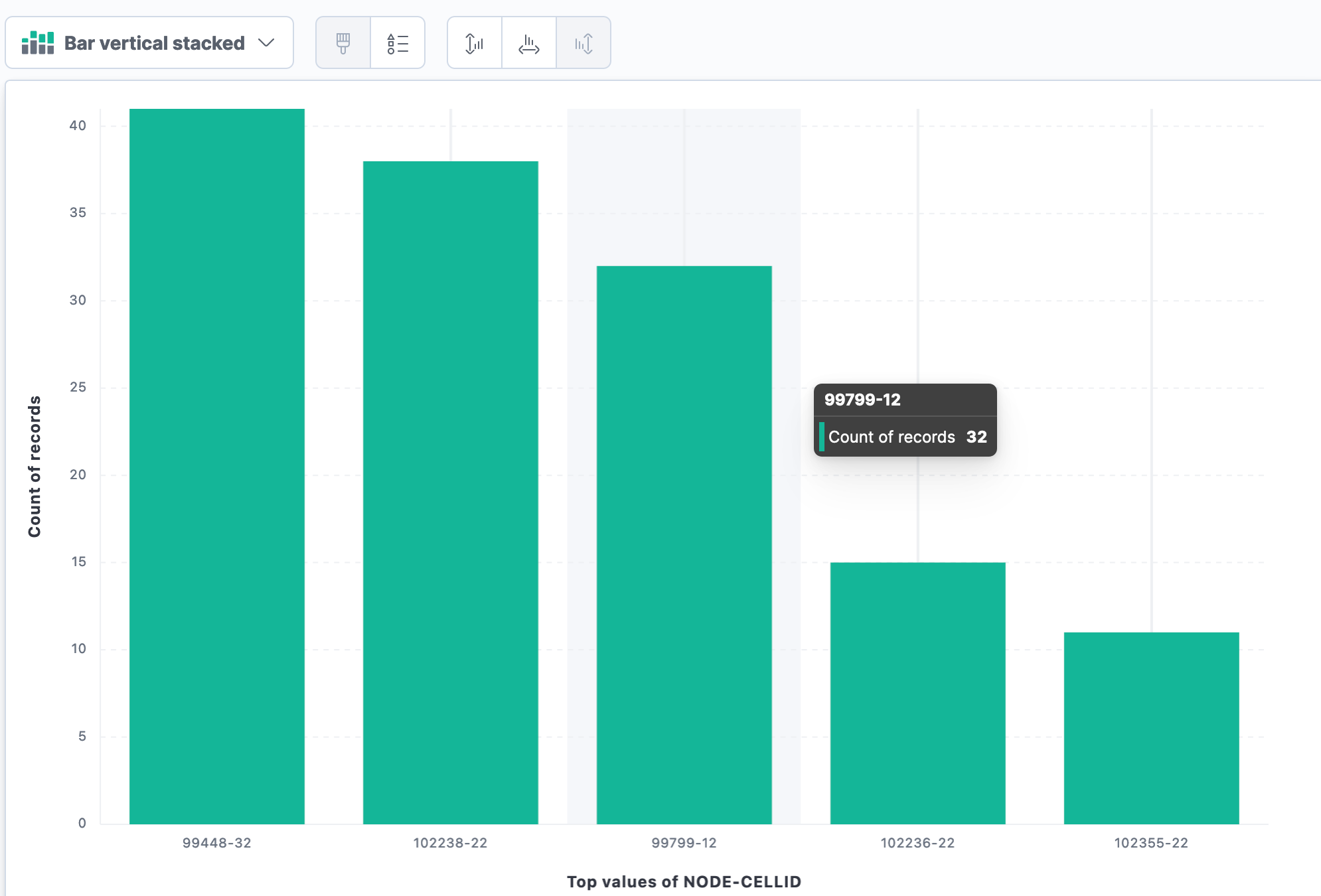
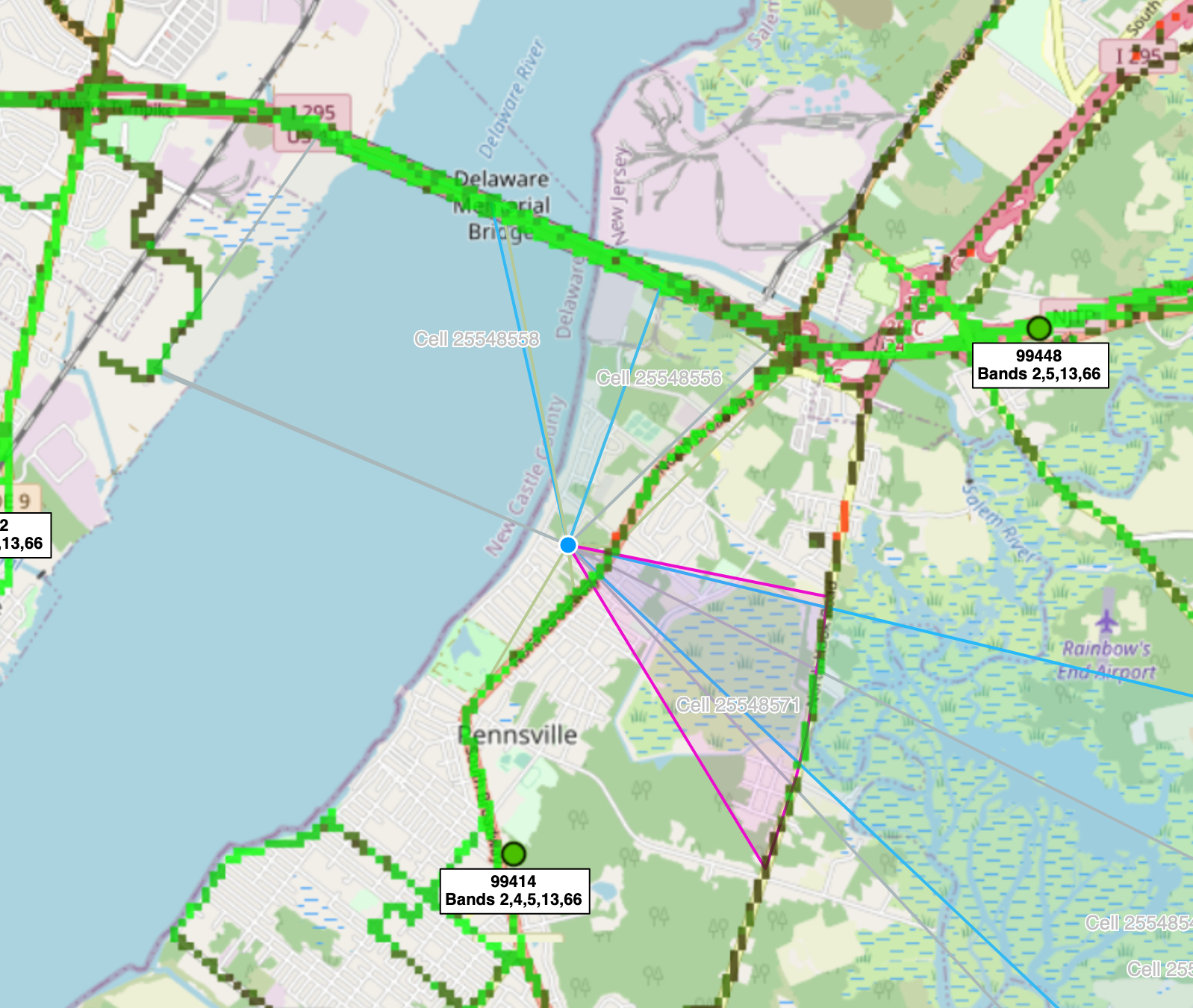
99448
This is on NJ side of bridge and is showing the correct cell coverage. No issues with this info.
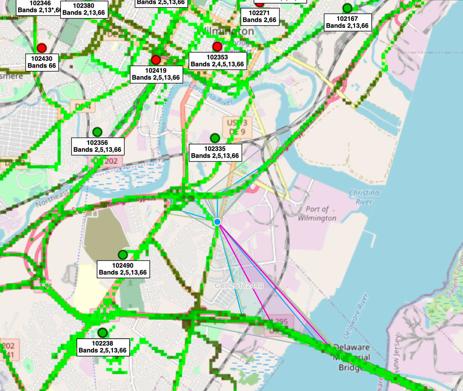
102238
This site also seemed fairly close to bridge.
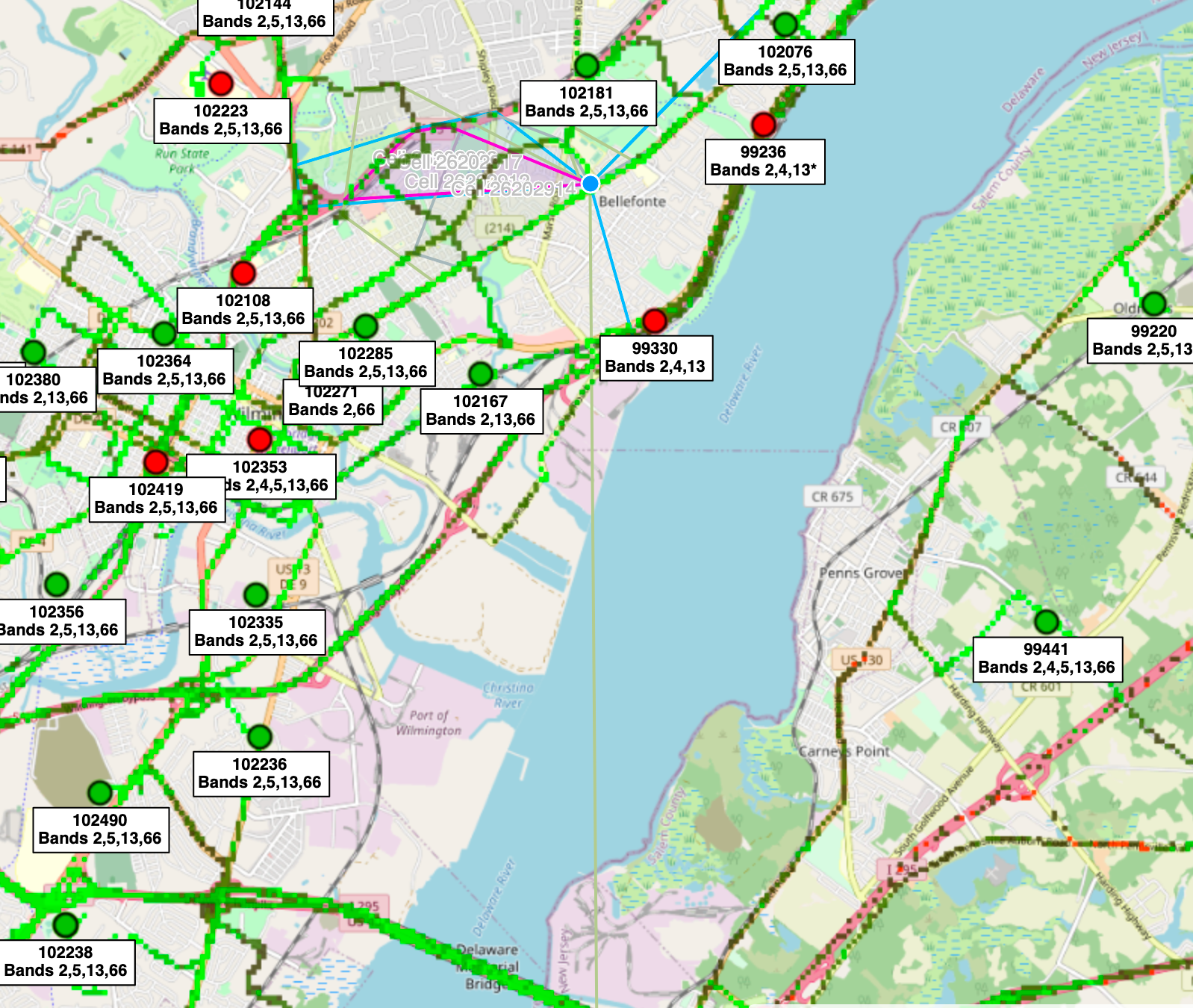
99799
Of the nodes listed, this was the only one that showed a bad signal (middle of bridge). It is close to the bridge. Surprised my phone did not switch to a different node/cell. Maybe congestion issue. Signal level/RSRP was -96 which is fairly good.
102236
This site also close to bridge. Nothing special to report.
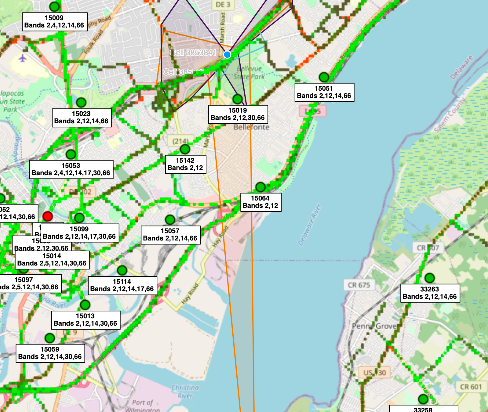
102355
Where Cellmapper shows this one is kind of far away (Bellafonte, DE) which is about 11 miles away. Either Cellmapper is wrong or the antenna tilt here is too high. Water propagation may also be a factor.
Conclusion
Some things we do know is that AT&T showed the largest number of bad quality plots (69) and it had the most context switching (8 different node/cell combinations). We also seen a that Cellmapper was showing a large majority of the AT&T sites being far away from the bridge. Whether this was due to misplacement in Cellmapper is the question (it is possible). There were other nodes/cells that were closer so I'm not sure why those ones were not chosen.
Verizon was the best during this experiment with T-Mobile second and AT&T last.
My point about context-switching could prove why AT&T was worse but it was not consistent with my findings with Verizon and T-Mobile. T-Mobile only showed 3 nodes/cells being used while on the bridge. Verizon had 5. One possibility is that Maybe Verizon cells are positioned/pointed in a better manner? Hard to say.
I will need to do similar analysis in the future to see if these findings continue to be true (on other high bridges) or even across the Delaware Memorial Bridge.