Updating Tower Locations
UPDATE TO ORIGINAL ARTICLE
*************************************************
In my article below I am using LTERSSI but it has been pointed out to me that RSRP is a better way to get signal strength (when that value is available) since it accounts for only the usable signal (no interference/noise). I'm going to leave this article as is since the concept is still the same. We basically want to look for the values that are closest to zero since a stronger signal will be less negative. Same concept but measuring in a different way
**************************************************
There are a couple of Verizon sites that are showing my home location as the tower-site on Cellmapper. I'm thinking that somehow my home Wifi signal is being misinterpreted somehow but I don't know for sure. Even when looking at my other test utilities, I am seeing a very strong LTE signal at my home. Maybe this is a bug with Android since the issue appears to be common with the Cellmapper app and G-NetTrack Pro. It is odd that I'm not seeing this with the other carriers though (only with Verizon).
Nonetheless, I wanted to do a post on finding the tower location on one of these sites. The NodeID is 101361. Here is how I would do this based on data I have gathered during my travels. NodeID is mostly synonymous with the tower site (in some cases there could be more than one nodeid per cell site but not common). Cell corresponds to a specific band/direction. Most towers have 3 panels (each at 120 degree directions).
First, I want to find the highest value of LTERSSI or level/RSRP (if it is only picking up 5G/NSA, the LTERSSI value is not getting populated). By highest value, I mean the number that is closest to 0.
Here is the query I am running against the dataset I gathered during August, 2021.
Operatorname : "Verizon_Wireless" AND Node : "101361". I then find the highest value of LTERSSI.
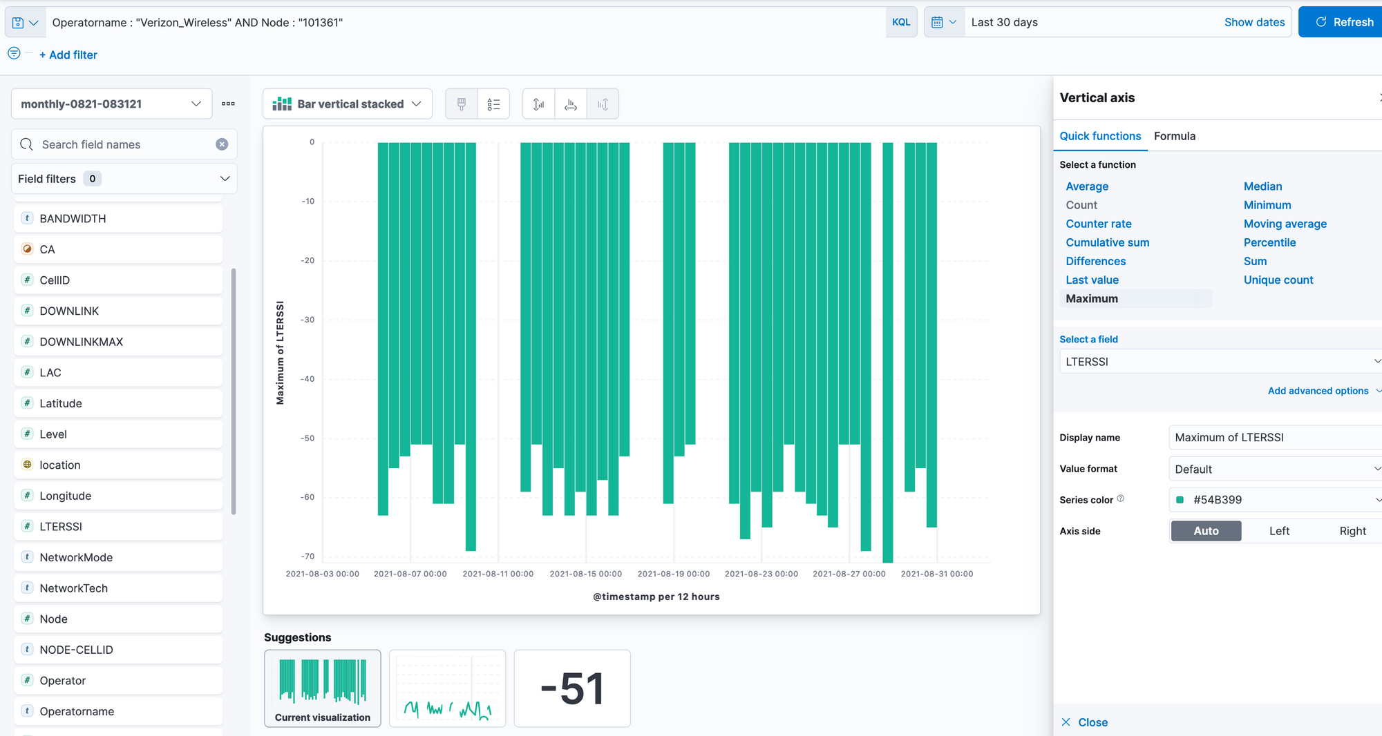
The highest value in all of my data is -51. Let's look for this using the Elasticsearch mapping function.
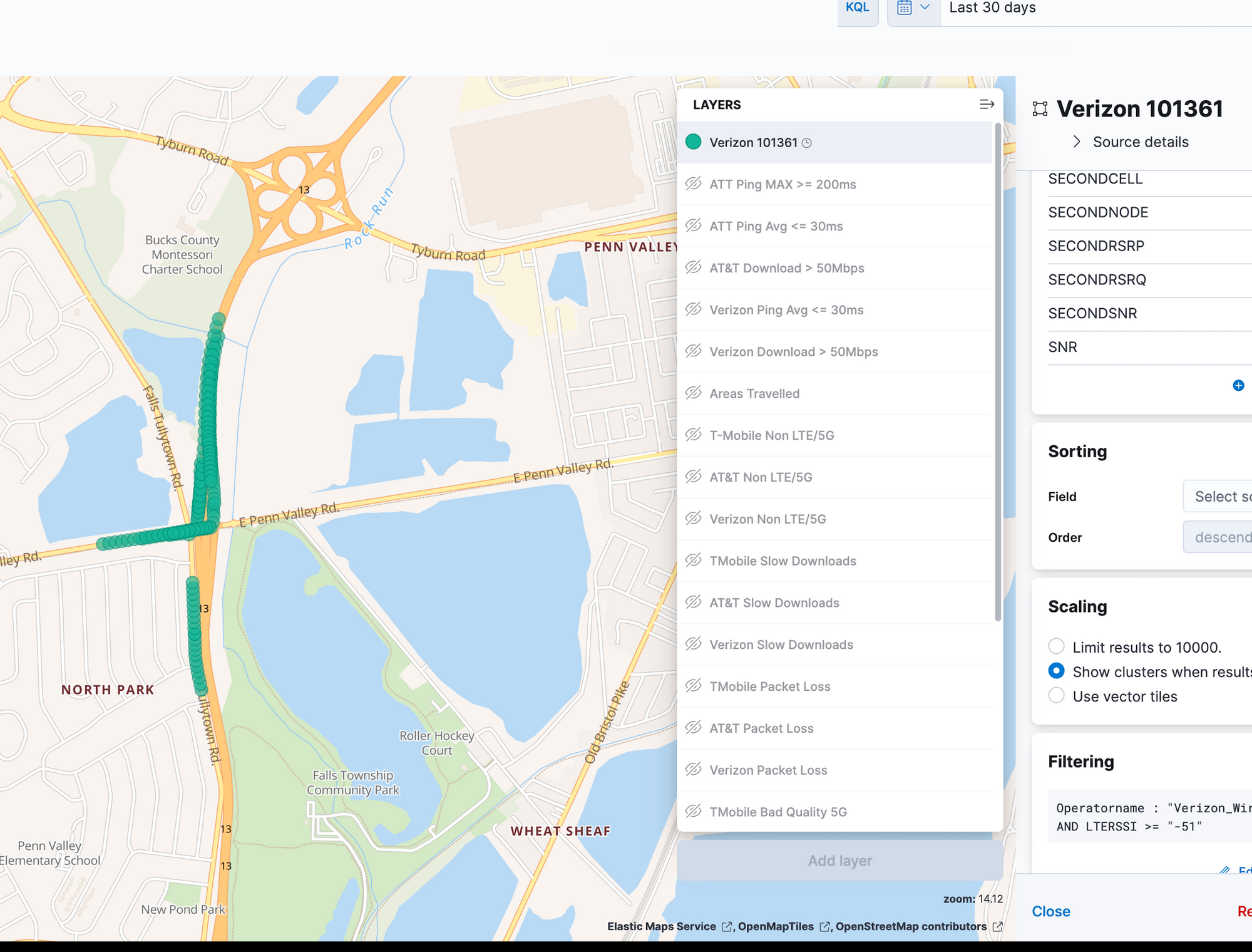
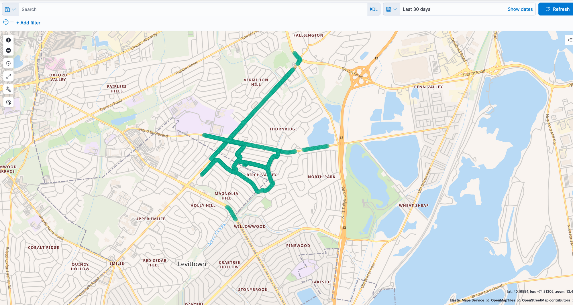
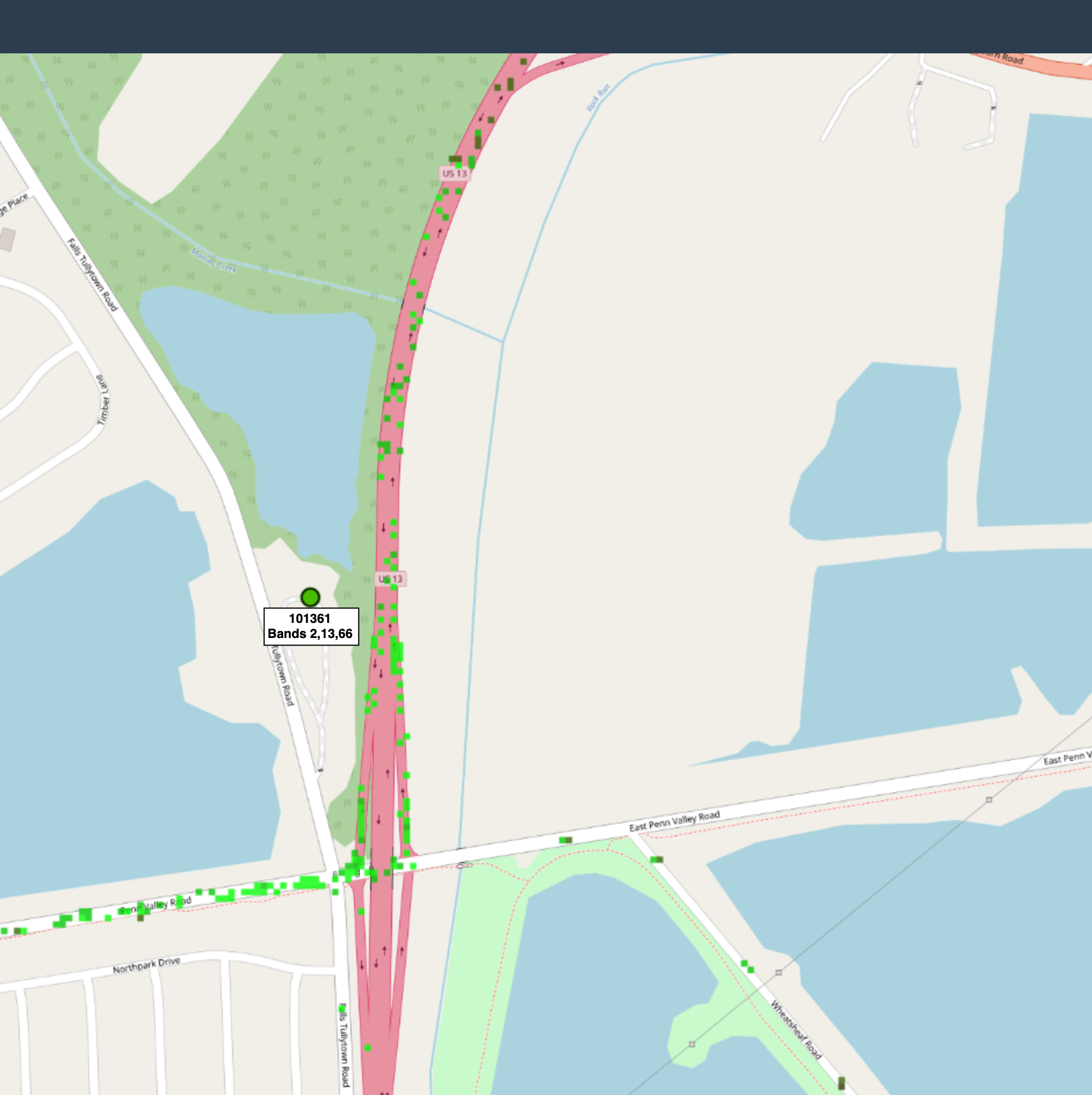
This location won't mean much to anyone else but the strongest signal is at the intersection of East Penn Valley Road and Route 13.
I haven't driven East of Route 13 on Penn Valley Road as of yet (this is why we don't see any green dots to the East. Somewhere in the middle of these plots (or roughly around that area) should be the cell site.
There is only one node/tower site in that area so I'm assuming this is the one. If we want to get real fancy, we could look at the different cells that show up. Each cell should cover an area of approximately 120 degrees.
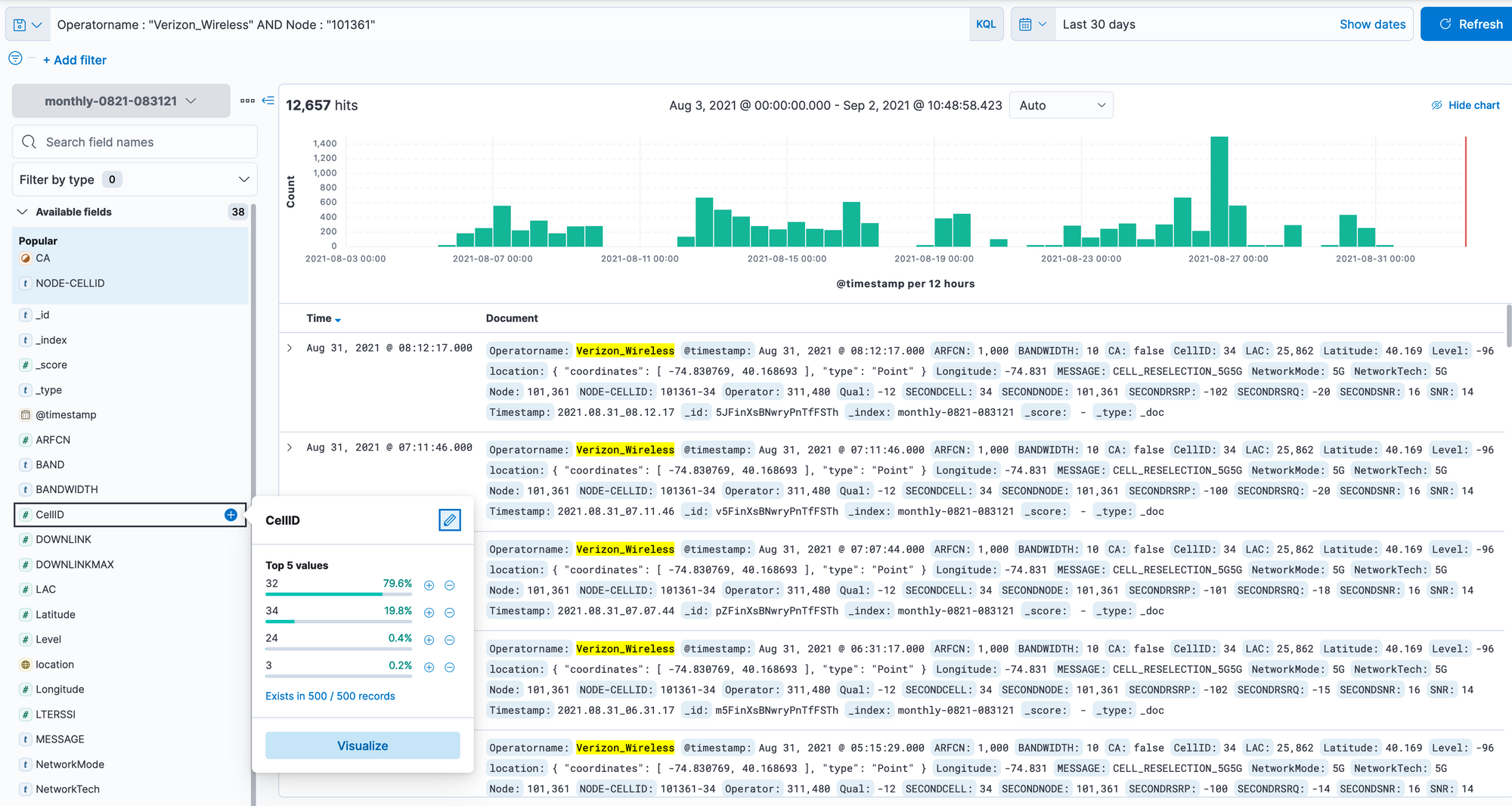
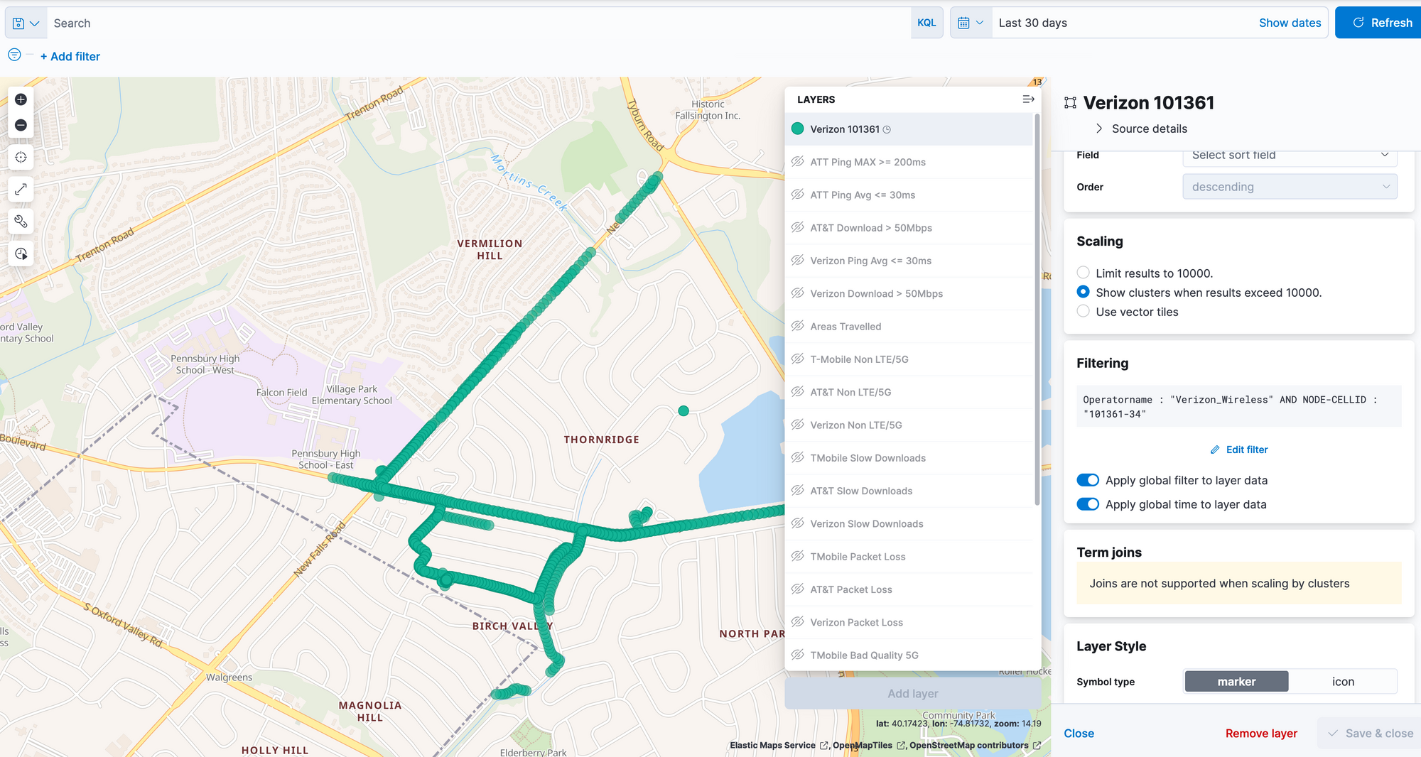
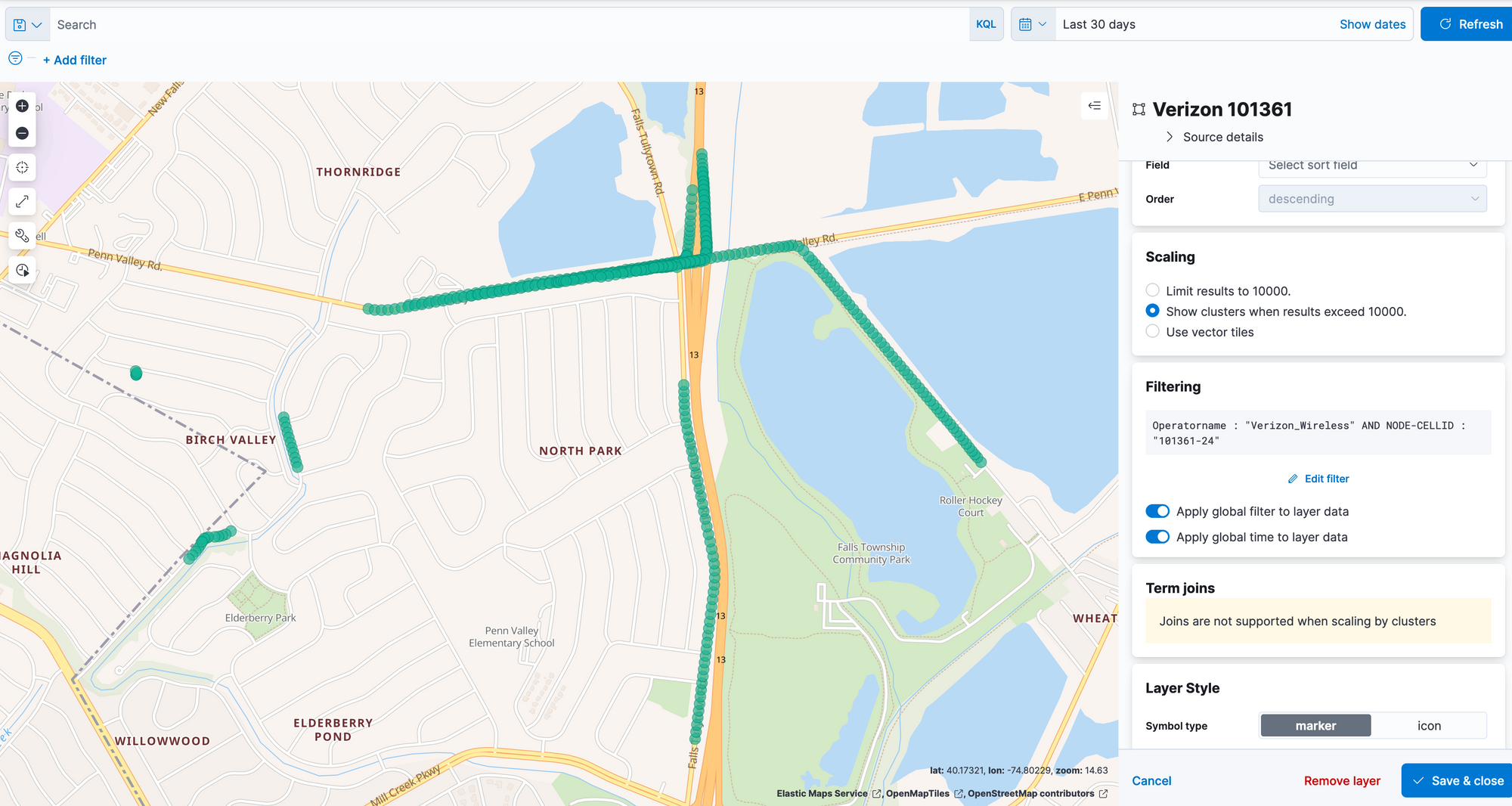
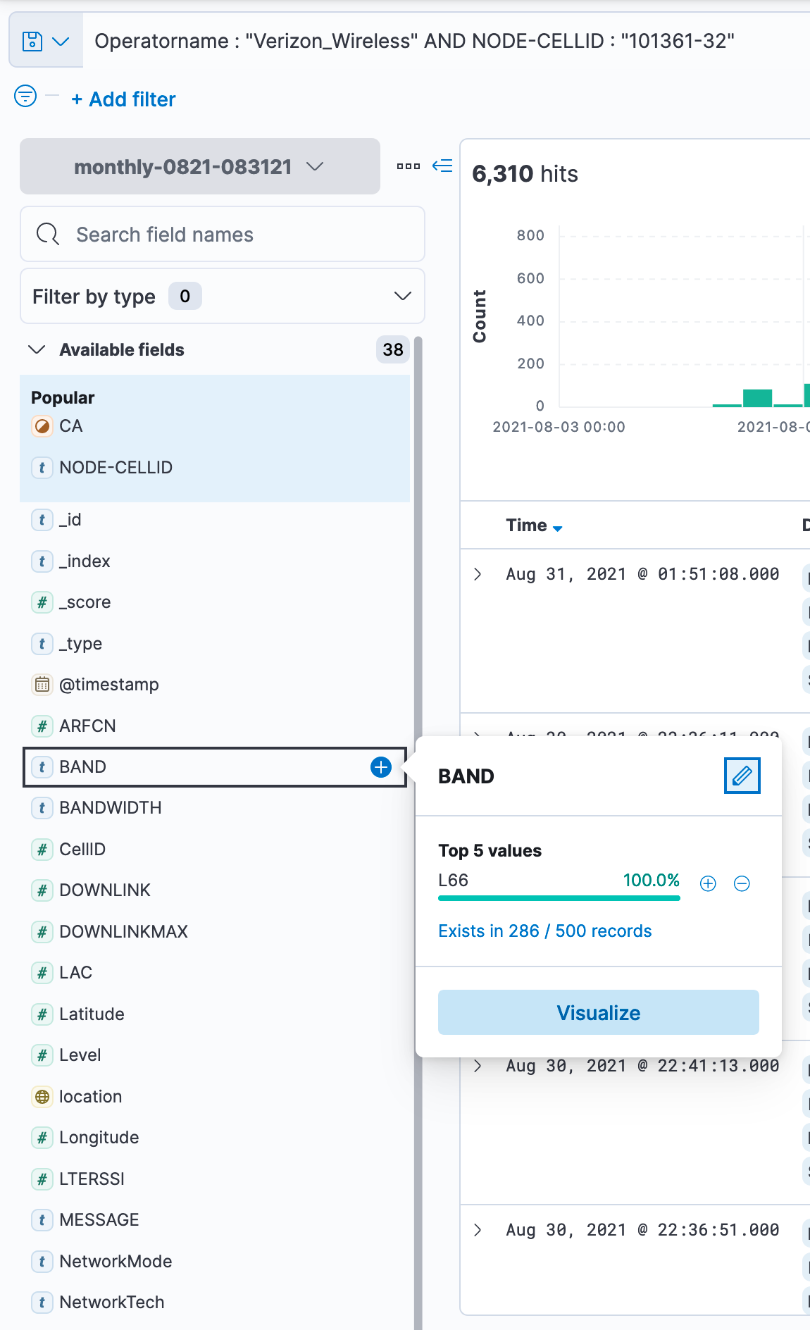
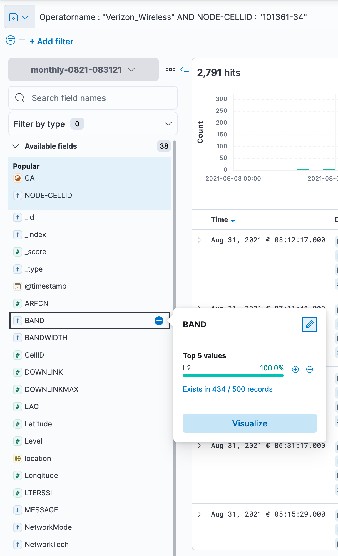
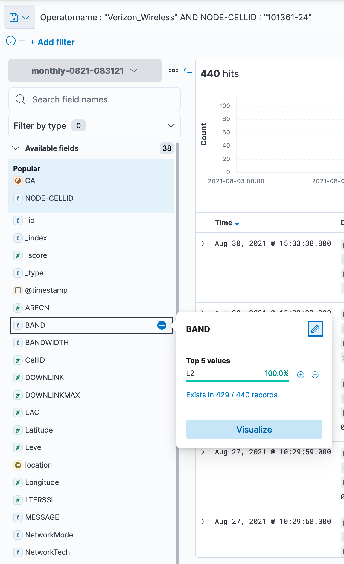
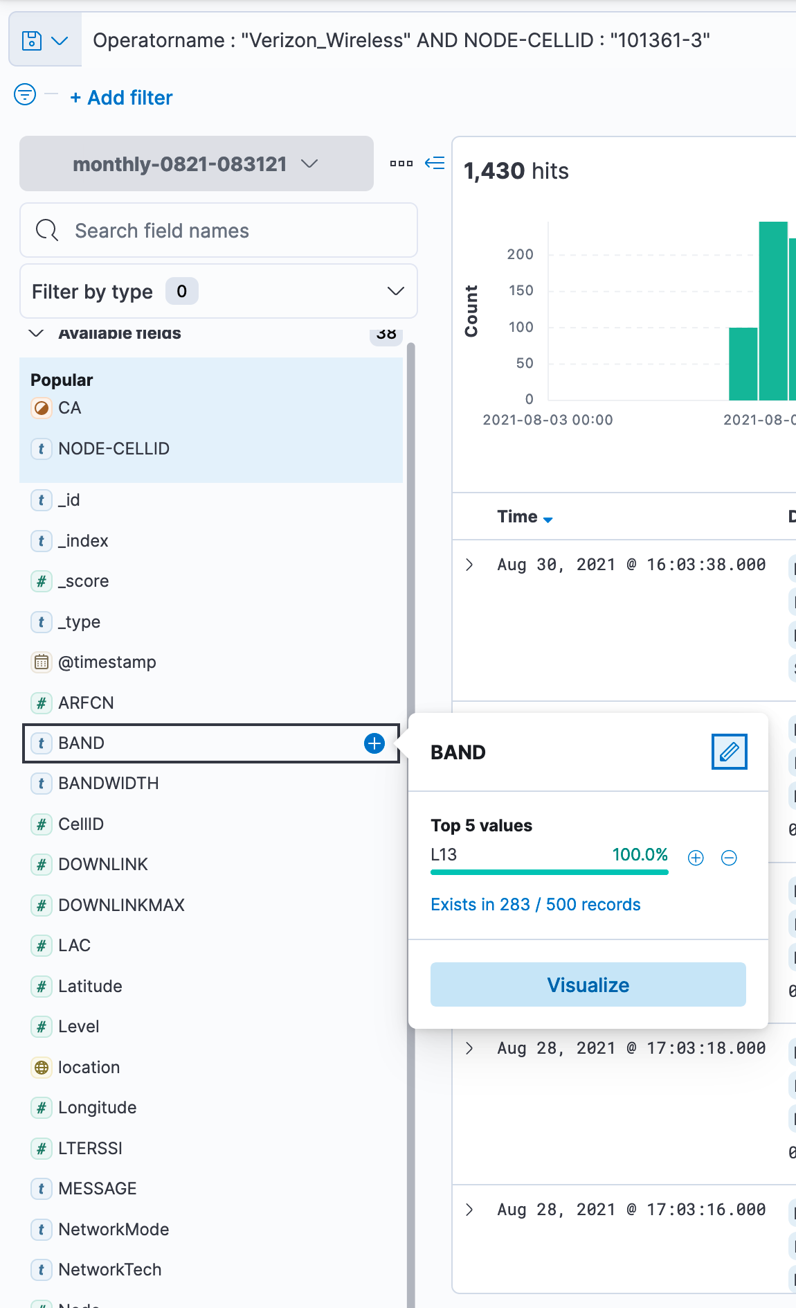
Let's get a list of all cells that show up for Node 101361. Look at the box called "CellID". This will show all the unique values for CellID that I picked up during my travels. We will see 32,34,24, and 3.
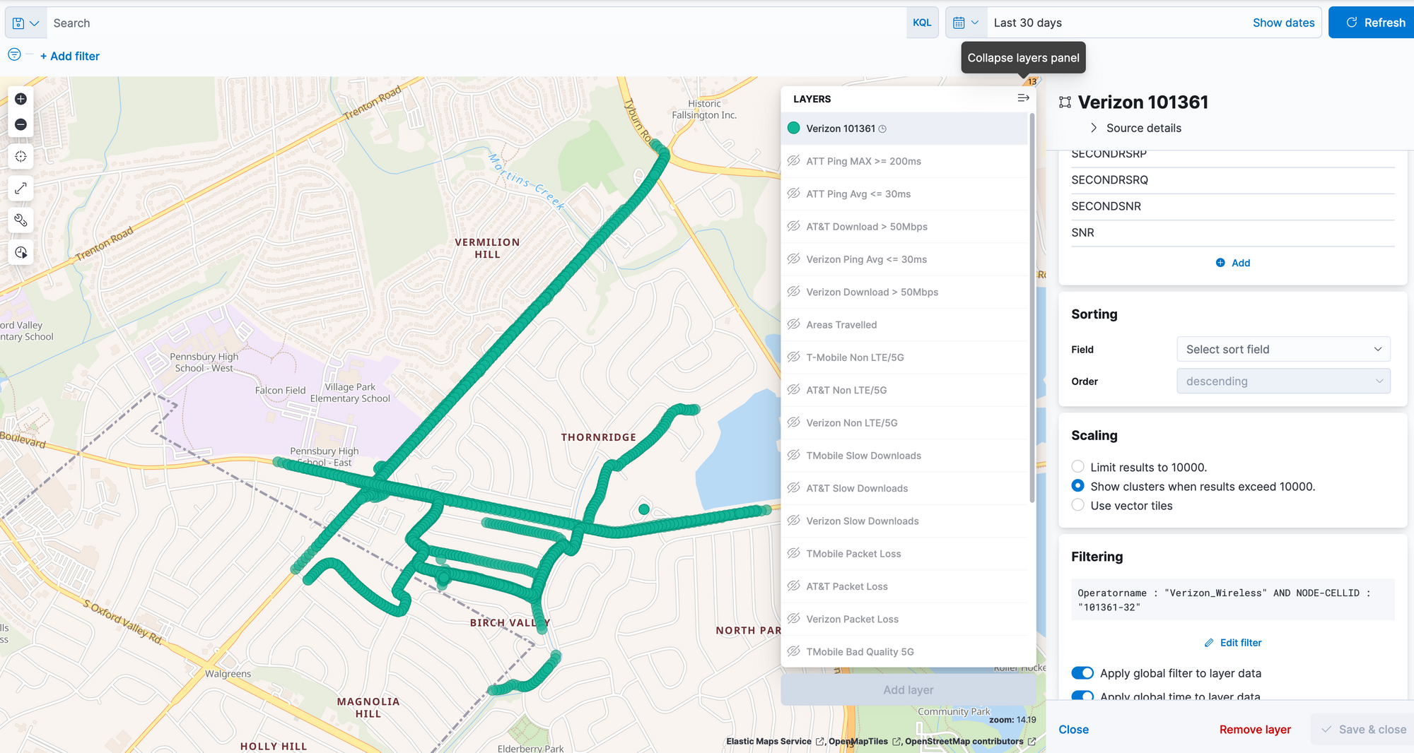
Let's plot the approximate direction that each of these cells cover.
The following plots will show the entire coverage area (based on my travels) with that cellid.
101361-32 (notice this site seems to cover a lot to the West)
101361-34 (looks like mostly the same direction)
101361-24 (this one shows to the East and South a little more)
101361-3 (West and a little to the South)
My thinking is that there are a lot of sectors pointing to the West but my travels also did not take me too far East. It is also possible that I could be transferred to different cells based a signal being better (either quality or signal wise) based on the direction I am travelling. Let's look at the breakdown of bands for each of these sectors.
101361-32 (Band 66/AWS-1700Mhz)
101361-34 (Band L2/1900 Mhz)
101361-24 (Band L2/1900 Mhz)
101361-3 (Band L13/700Mhz)
Based on the information I have, I have already moved this tower to (what I believe is the correct location) on Cellmapper.
I hope you have found this article helpful.